An official website of the United States government.
  Official websites use .gov
A .gov website belongs to an official government organization in the United States.
Official websites use .gov
A .gov website belongs to an official government organization in the United States. Secure .gov websites use HTTPS
A lock or https:// means you’ve safely connected to the .gov website. Share sensitive information only on official, secure websites.
Secure .gov websites use HTTPS
A lock or https:// means you’ve safely connected to the .gov website. Share sensitive information only on official, secure websites.Spatial Planning
Coastal and marine planning plays an important role in sustainable coastal and ocean development. Spatial planning supports diverse and stable working waterfronts in the face of environmental change and economic uncertainty. Sustainable coastal planning and development creates jobs, reduces reliance on unsustainable imports, supports renewable energy, and improves the domestic Blue Economy. Rigorous spatial planning and stewardship help minimize conflicts among ocean users and mitigate negative impacts to sensitive species and habitats. NCCOS works closely with partners to develop spatial models, which incorporate important considerations and provide outputs for easier consumption, enabling more informed, inclusive, and transparent coastal and marine planning efforts.
How Spatial Modeling Works

A mockup of a spatial suitability map in the Gulf of Mexico.
Spatial modeling is a powerful tool for understanding ocean ecosystems and the interactions of human uses and natural resources. Early and comprehensive spatial planning helps avoid conflicts and minimizes environmental impacts. Spatial suitability modeling provides a mathematical calculation that is understandable, with minimal bias to support siting decisions. Models range from simple to complex—with varying numbers of data layers, model structure, and other factors—and can be small (tens of acres) or large (millions of acres). Each model calculates a unique suitability score for each grid cell within a study area using the underlying data that are available. The model then identifies the grid cells with the highest scores, revealing the optimal areas. The team then develops heat maps that identify hotspots of relative suitability and conflict. These spatial modeling products provide new intelligence about the study area, enabling decision-makers to simultaneously consider data from multiple ocean sectors.
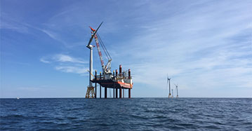
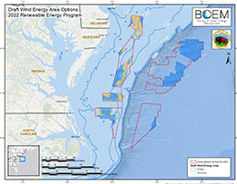
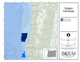
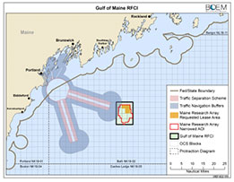
Offshore Wind Energy
In support of NOAA’s renewable energy efforts, we have partnered with BOEM to help identify the most suitable locations for offshore wind energy siting. The offshore wind team is developing comprehensive spatial models to help characterize ocean environments and industries to more holistically and efficiently inform BOEM’s decision-making on offshore wind siting. The team has completed models for the Gulf of Mexico and Central Atlantic with models for Oregon and the Gulf of Maine in development. In addition, the team is developing cable routing models to help inform energy transmission.
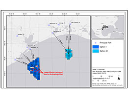
Aquaculture
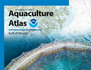
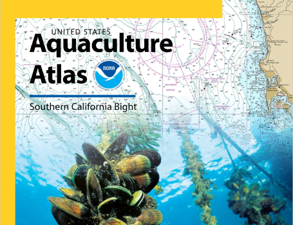
NCCOS developed the first whole-ecosystem and regional-scale spatial suitability models for ocean planning for
Aquaculture Opportunity Areas in the U.S. Gulf of Mexico and Southern California Bight. These spatial models
include hundreds of data layers for ocean sectors such as transportation, natural resources, national security,
fisheries, and other ocean industries.
Tools to Support Spatial Planning
NCCOS has developed tools that compile hundreds of data layers into a web-based, automated geospatial platform to visualize ocean space. These tools contain national and regional data on energy and minerals, natural and cultural resources, oceanographic characteristics, transportation and infrastructure, and economics that can be used to support spatial planning and increase transparency and efficiency for offshore planning and permitting within the U.S. Exclusive Economic Zone.